



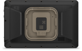
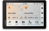
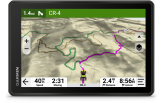
Offroad GPS Tread 2 8"- Overland
An off-road sat nav with an 8-inch display and detailed topographic maps, built for large off-road vehicles.
This purchase makes you a club member for free
Read more- Club prices on all products
- 1 free parcel locker delivery a year
- Valid for 3 years, every purchase extends it
- Monthly member offers

 4.8
866 reviews
GPS Eesti on Google


Available on special order. Write to us at abi@gpseesti.ee
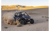
ROAM THE UNKNOWN ON YOUR NEXT EXPEDITION
This rugged all-terrain sat nav will show you the way, with navigation that guides you through even the most remote areas less travelled.

ULTRABRIGHT, GLOVE-FRIENDLY 8-INCH DISPLAY

TURN-BY-TURN TRAIL NAVIGATION WITH TOPOGRAPHIC MAPS FOR EUROPE, AFRICA AND THE MIDDLE EAST

CUSTOM STREET ROUTING BASED ON THE SIZE AND WEIGHT OF YOUR VEHICLE1

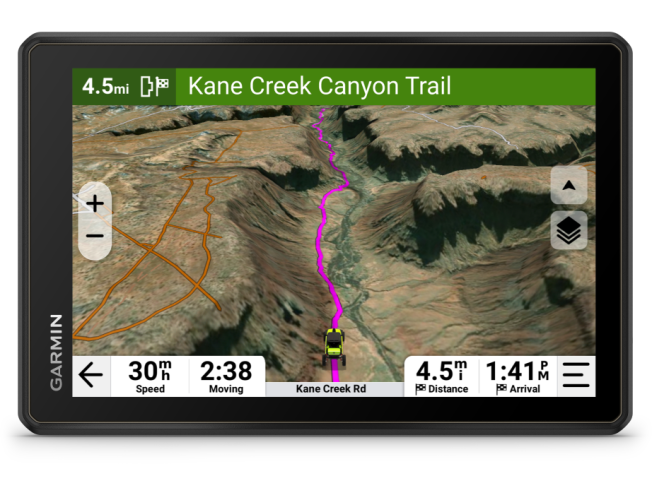
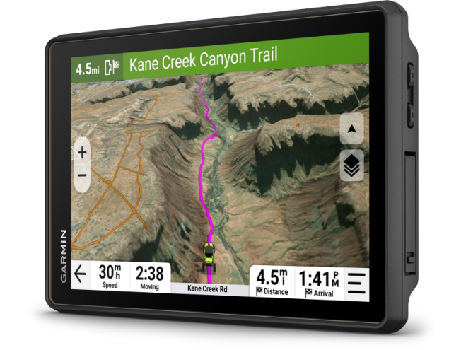
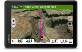
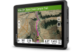
SATELLITE IMAGERY SHOWS VIVID OVERHEAD VIEWS OF YOUR ROUTE

USE THE TREAD APP ON YOUR COMPATIBLE SMARTPHONE FOR EASY ROUTE PLANNING AND MORE

SUPPORTS OUTDOOR MAPS+ FOR PREMIUM MAPPING (SUBSCRIPTION REQUIRED)
RUGGED DESIGN
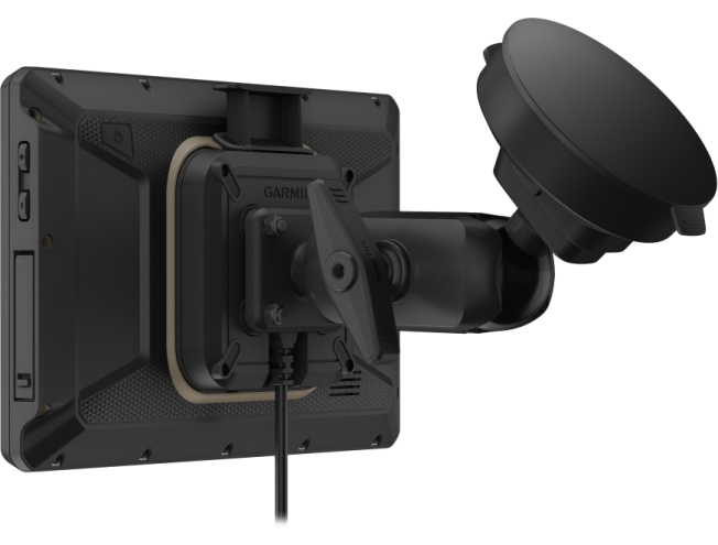
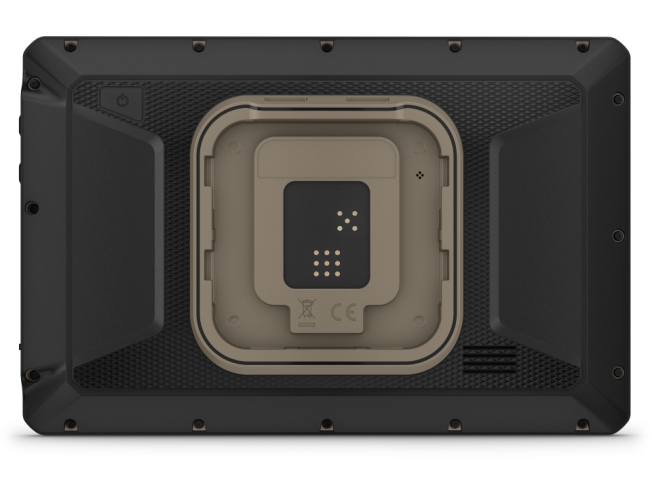
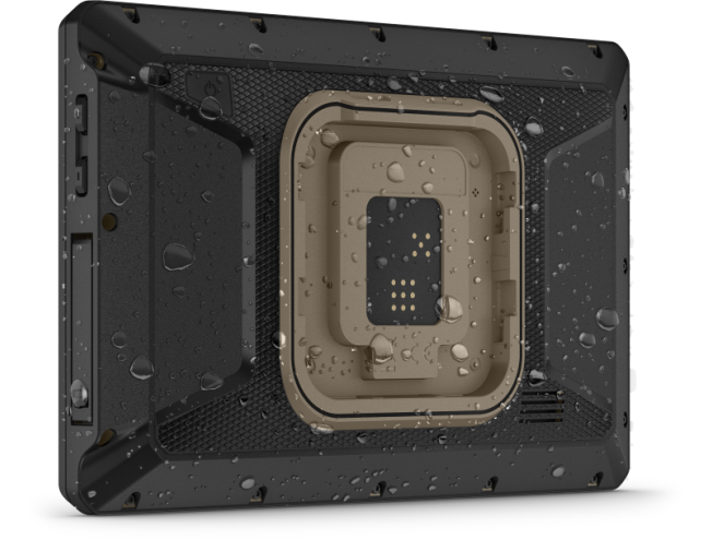
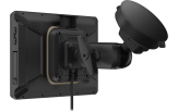
This 8-inch high-resolution, ultrabright and glove-friendly touchscreen sat nav is purpose-built to withstand extreme temperatures and weather conditions (IP67 dust and water rating) for your toughest off-road adventures. Heavy-duty mounting hardware withstands high vibration and shock. Plus, an enhanced processor is faster than before at both rendering maps and calculating routes.
TURN-BY-TURN NAVIGATION
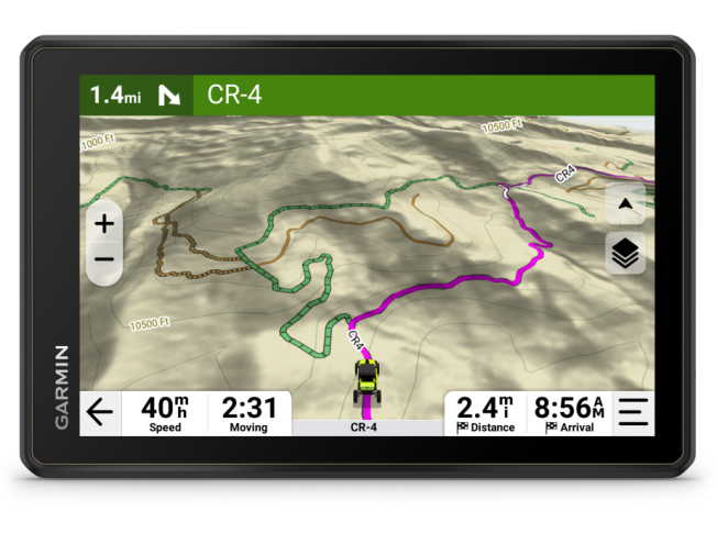
Get turn-by-turn directions for unpaved roads and off-road trails using OpenStreetMap™ and Adventure Roads and Trails map content2 for Europe, Africa and the Middle East.
SATELLITE VIEWS
Download subscription-free satellite imagery directly to your device via Wi-Fi® technology and enjoy high-resolution overhead views of routes and terrain.
Custom routing
Get City Navigator® maps of Europe, Africa and the Middle East. Street routing in Europe customised to the size and weight of your vehicle1. Plus, get alerts about potential hazards along your route, including sharp curves, speed changes and more.
EASY ROUTE PLANNER
Use the Tread smartphone app to easily plan routes with the same maps, vehicle profiles and route preferences that you have on the Tread device. Import and export GPX files to share your favourite routes with your fellow riders.
OUTDOOR MAPS+
Purchase an Outdoor Maps+ subscription to get continuous access to a wide range of premium mapping content, including elevation maps, land ownership and more.
CAMPSITES
The Tread 2 sat nav comes with a preloaded directory of ACSI™, Campercontact™ and Trailer's PARK™ campsites to help you find more camping locations.
GROUP RIDE MOBILE
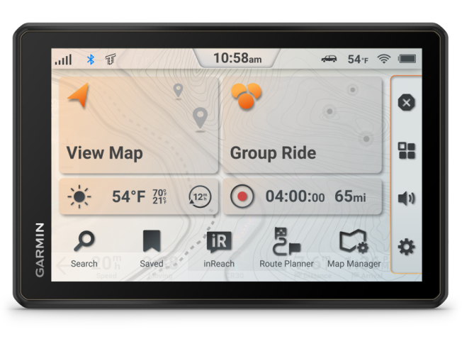
Track friends from your compatible smartphone or Tread device when you and your friends use the Tread app's group ride mobile feature.
SYNC YOUR DEVICES
Use the Tread mobile app to easily sync waypoints, tracks, routes and collections across your mobile device and Tread 2 sat nav.
ABC SENSORS
For tough-terrain guidance, built-in sensors include an altimeter, barometer and compass.
LIVE WEATHER
Weather ahead? Pair Tread 2 with your compatible smartphone, and download the Tread app to access live weather, storm alerts, animated radar and more.
TRAVELLING MUSIC
The built-in media player lets you easily control music on your compatible smartphone from the sat nav screen – and listen through your Bluetooth®-enabled helmet or headset
Digital switch box.
Control your vehicle’s 12 V electronics – including light bars, differential lockers and more – directly from the screen when you pair the device with a Garmin PowerSwitch™ digital switch box. This device is not intended to control reverse-polarity motors.
INREACH® TECHNOLOGY
Pair your Tread 2 - Overland Edition with a compatible inReach global satellite communicator3 to use two-way messaging, interactive SOS and weather forecasts. With select devices, you can even send photo and voice messages.
DOG TRACKING
Wirelessly pair your Tread 2 sat nav with a compatible Garmin GPS dog tracking device to help track and recover sporting dogs in the field. You will see markers for each dog within tracking range, shown as a map layer directly on the sat nav map screen.
Group Ride Tracker
Pair your sat nav with a compatible group ride tracker (sold separately) for group tracking4 and sending preset messages.
HANDLEBAR CONTROLLER
After pairing the wired handlebar controller (sold separately), you can control key map functions with buttons without taking your hands off the handlebars while riding.
1Not available in all areas. Entering your vehicle profile characteristics does not guarantee that your vehicle’s characteristics will be accounted for in all route suggestions. Always obey all posted road signs and road conditions.
2Map data may be limited for route suggestions on some roads and trails. Always pay attention to all road signs and road conditions. Garmin products using OpenStreetMap data are intended to be used only as supplemental travel aids.
3Active satellite subscription required. Some jurisdictions regulate or prohibit the use of satellite communication devices. It is the responsibility of the user to know and follow all applicable laws in the jurisdictions where the device is intended to be used.
4Group tracking is available for riders using a Tread navigation device, and only riders with a Tread sat nav can be tracked. Group tracking requires a connection to the vehicle’s power system.
Satellite imagery © 2025 Maxar Technologies (satellite imagery dates may vary). OpenStreetMap is a trademark of the OpenStreetMap Foundation and is used with their permission. This product is not endorsed by or affiliated with the OpenStreetMap Foundation. Wi-Fi is a registered trademark of Wi-Fi Alliance. The Bluetooth word mark and logos are registered trademarks owned by Bluetooth SIG, Inc. and any use of such marks by Garmin is under license. ©2025 ACSI Publishing B.V. All publishing rights reserved. NKC campercontact data: ©2025 Nederlandse Kampeerauto Club “N.K.C.”
Tracks4Africa
Because engineers are constantly updating products, they may not always be reflected in images, videos and specifications.
General | |
| Dimension | 20.6 x 13.7 x 2.8 cm (8.1″W x 5.4″H x 1.1″D) |
|---|---|
| Weight | 627 g (22.1 oz) |
| Water rating | IPX7 |
| Display Type | Multi-touch, glass, high brightness HD colour TFT with white backlight |
| Display Size | 10.8 cm x 17.2 cm (6.8″W x 4.2″H); 20.3 cm diagonal (8″) |
| Display Resolution | 1280 x 800 pixels |
| Dual-Orientation Display | |
| Magnetic Mount | Locking magnet-assisted mount |
| 1.5-inch ball adapter with AMPS plate | |
| Drop rating | MIL-STD-810 |
| Dust rating | IP6X |
| Battery type | Rechargeable lithium-ion |
| Battery life | Up to 6 hours at 50% backlight Up to 1 hour at 100% backlight |
Maps & memory | |
| Data cards | microSD™ card (not included) |
|---|---|
| Preloaded street maps | |
| High-definition 3D terrain | |
| 3D Terrain | |
| Internal storage | 64 GB |
| Ability to add maps | |
| Storage and Power Capacity | Yes (256 GB max microSD™ card) |
| Includes map updates | |
| Downloadable Satellite Imagery | |
| TOPO map support | |
Sensors | |
| GPS | |
|---|---|
| Galileo | |
| Barometric altimeter | |
| Compass | |
| 10 Hz multi-GNSS positioning | |
Outdoor recreation | |
| PRELOADED TOPOGRAPHIC MAPS | |
|---|---|
| Preloaded US public land boundaries | |
| Preloaded private land parcel maps | Yes (parcels greater than 4 acres) |
| Preloaded USFS Roads and Trails, including motor-vehicle-use-maps for motorcycle, ATV, SXS and full-size 4x4 | |
| Navigate-a-track navigation | |
| Turn-by-turn trail navigation | |
| Compatible with Outdoor Maps+ Subscription | |
Mapping & Navigation | |
| Point-to-point navigation | |
|---|---|
Camera features | |
| Backup camera compatible | Yes (BC™ 50 only) |
|---|---|
Navigation features | |
| Garmin Real Directions™ landmark guidance | |
|---|---|
| TripAdvisor® Traveller Ratings | |
| Route shaping through preferred cities/streets | |
| Traffic Updates | Yes (with Garmin Tread app) |
| Lane assist with junction view (displays junction signs) | |
| Bluetooth® calling | Yes (works with BLUETOOTH-compatible helmet, headset or smartphone; BLE capable) |
| Speed limit indicator (displays speed limit for most major roads) | |
Advanced features | |
| Smart notifications via app | |
|---|---|
| Wi-Fi® map and software updates | |
| Access to live services via app | |
Motorcycle features | |
| Control music and media from smartphone or MP3 player | |
|---|---|
| Sunlight readable and weather resistant | |
| GARMIN ADVENTUROUS ROUTING™ | |
| Elevation profile | |
| Round trip routing | |
| Custom map support | |
Camper Features | |
| Specialised routing for the size and weight of your vehicle | |
|---|---|
| Camper Sites & Services Directory | |
| Road elevations | |
| Speed limit changes | |
| Easy Route Planner with GPX file sharing | |
Adventure features | |
| Pair with Garmin PowerSwitch™ digital switch box | |
|---|---|
| Compatible with handlebar controller | |
| Compatible with Group Ride Tracker (6”, 8” and 10”) | |
| Compatible with external GPS antenna with mount | |
| Group Ride Mobile | Yes (with Garmin Tread app) |
| Track recorder (breadcrumbs) | |
| Compatible with the Garmin Tread app for route planning and data management (waypoints, tracks, and routes) | |
| ACSI, Campercontact and Trailer's PARK | |
| Pitch and roll gauges | |
| Glove-friendly touchscreen | |
Outdoor applications | |
| Dog tracking | Yes (when paired to compatible dog track system) |
|---|---|
Security and Legal Information | |
| Security updates until at least (YYYY-MM-DD) | 2027-06-10 |
|---|---|
- Tread® 2 - Overland Edition
- Suction cup mount
- Vehicle power cable
- Locking magnet-assisted mount
- USB cable
- Documentation
8″ All-Terrain Navigator and Garmin PowerSwitch™ (BUNDLE-TDOE2-PWR)
- Tread® 2 - Overland Edition
- Suction cup mount
- Vehicle power cable
- Locking magnet-assisted mount
- USB cable
- Documentation
- Garmin PowerSwitch
- Power Cable
- Ground cable
- Terminals
Frequently asked questions
How often are map updates released?
Garmin City Navigator kaardiuuendused ilmuvad tavaliselt kuni kolm korda aastas.
Eluaegse Euroopa kaardi uuenduse ostjad saavad laadida uusi kaarte otse internetist kuni 3 korda aastas.
Kaarte saab uuendada Garmin Express programmiga.
Traffic information coverage in Europe
Garmin FM traffic information coverage in Europe
(LMT/MT-D):
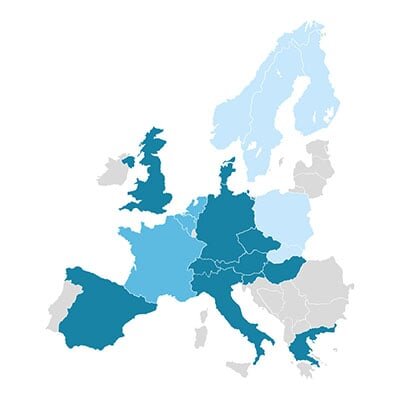
 Available
 Available until December 2025
 Available until March 2025
LMT/MT-D devices can also use traffic information from the Smartphone Link/Garmin Drive app via a smartphone*.
Garmin Smartphone Link/Garmin Drive app traffic information coverage in Europe
(LMT-S/ MT-S)*:

 Available
*Requires a smartphone with an internet connection. Average data usage ~2MB per hour
Mass storage mode on newer Garmin devices
Newer Garmin devices no longer connect to a computer in mass storage mode, but as media devices. This means older Garmin applications cannot be used, and sometimes there may be problems updating the device. To put the device into mass storage mode, follow these instructions: Turn...
What is GPS and how accurate is it?
WHAT IS GPS? The Global Positioning System (GPS) is a satellite navigation system owned by the US government, currently made up of at least 24 operational satellites. GPS works in any weather conditions, anywhere in the world, 24 hours a day, with no subscription or setup fees. T...
