



 Garmin Custom Maps
Download paper and electronic maps to your map-enabled Garmin handheld GPS device.
Compatibility: Dakota 10 and 20 | Colorado | Oregon series | Montana series | Monterra | GPSMAP 62 series | GPSMAP 64 series| GPSMAP 78 series | eTrex 20/30 and 20x/30x | eTrex Touch 25 and 35 | Edge 800 and 810 | Astro 320 | Alpha 100 | Zümo 590 |
Overview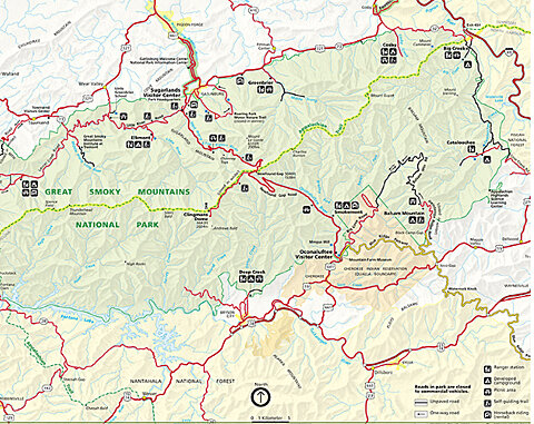
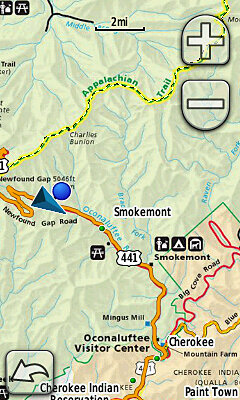
Sometimes the best map of an area is in electronic or printed form. For example, you're planning a hike in a nearby national park, but you're worried whether the trail is marked well enough on your GPS map, or whether you can navigate with a paper map. If only you could make your handheld GPS show the paper map.
Introducing Custom Maps for Garmin devices – a free and simple process that turns paper or electronic maps into downloadable maps for your compatible handheld GPS device. Custom Maps are created using Garmin map rendering technology to digitise map images and efficiently download the paper or electronic map to your device.
Besides safety on the trail, Custom Maps also offer convenience in everyday situations. For example, you need to see cadastral boundaries in a specific area. Solution: download an electronic map (as an image) from the internet and create your own map from it. Finding cadastral boundaries has never been easier.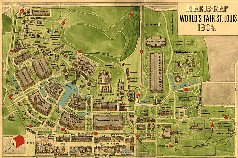
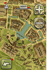
In addition to their practical value, Custom Maps can also be educational and entertaining. By loading a map of an area as it once was, you can go back in time and explore it both as it was then and as it is now.
Whether it's a hiking trail, cadastral boundaries or a map from years ago, with just a few simple steps Custom Maps are on your GPS.
Garmin Custom Maps work on Windows and Mac computers.
Instructions
Before loading Custom Maps, you must install the latest software update on your handheld device. To do so, visit https://www.gpseesti.ee/webupdater
When creating a custom map, please be responsible and only create maps from public sources for which you have copyright permission.
1. Save the map in JPEG format
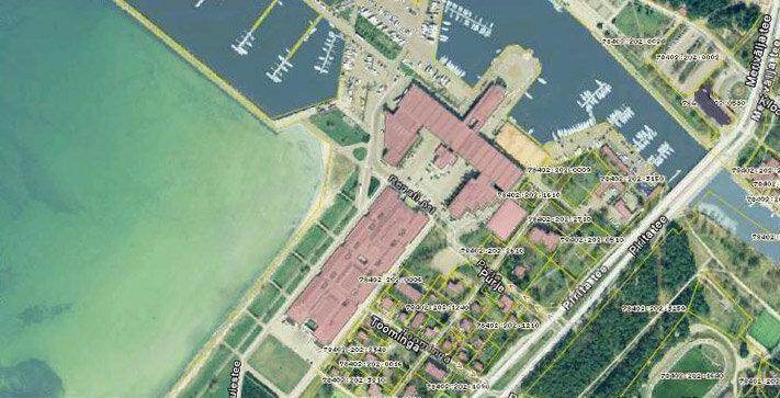
The Garmin Custom Maps feature requires the map to be saved in JPEG format.
* If the map is on paper, scan it at a suitable resolution¹ and save it as a JPEG file.
* If the map is electronic, e.g. a PDF, you will need to convert it to a suitable JPEG format using an image editing program.
2. Create an image overlay
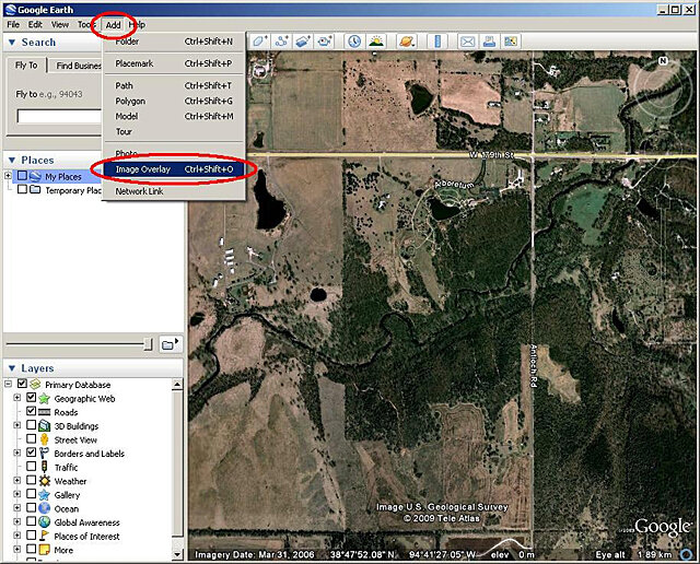
Using Google™ Earth, find the approximate area² your custom map will cover.
In the top toolbar, click Add > Image Overlay. A new Image Overlay window appears.
3. Link to the JPEG image
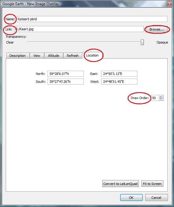
In the new Image Overlay window, fill in the following:
o Enter a name.
o In the Link field, use the Browse button to add the location of the JPEG image on your computer.
o Use the Location tab to change the map's draw order if needed. Draw order determines the order in which maps are drawn on your device. For example, if the draw order is 50 or higher, your custom map will appear on top of the standard Garmin map.
4. Calibrate the JPEG image
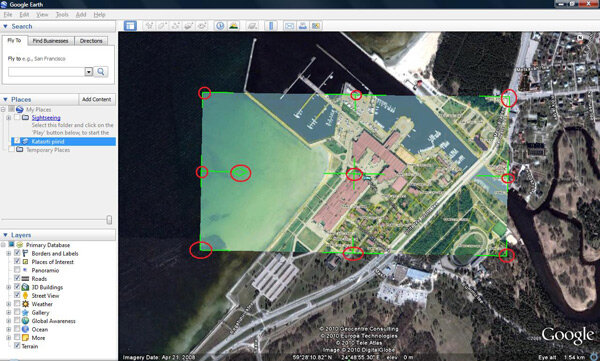
Before closing the New Image Overlay window, you must calibrate (geo-reference) your JPEG image to the Google satellite image below.
Move the green markers to adjust the corners, edges and centre, or to rotate the JPEG image. You may need to change the JPEG image's transparency so the satellite imagery shows through. Use the Transparency slider at the top of the New Image Overlay window.
To save your custom map, click OK.
5. Send your map to your GPS device
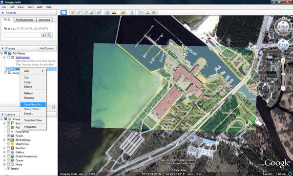
Connect your map-enabled Garmin handheld GPS device to your computer.
On the left side of Google Earth, right-click your custom map.
Click Save Place AS.
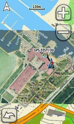
In the window that opens, find the drive of the device connected to your computer and save³ your custom map to the /Garmin/CustomMaps/ folder.
Save the file in KMZ format. (Saving to a memory card is recommended.)
Your custom map will appear as part of the Garmin map on your handheld GPS device.
Disabling a Custom Map
By default, Custom Maps are enabled on Garmin devices.
To turn off a map on Dakota or Oregon:
Select Setup > Map > Map Information. Uncheck the custom map box.
On Colorado:
Go to the map page and select Setup > Select Map. Scroll to the custom map and uncheck its box
¹Oregon and Colorado devices have a resolution of 155 dpi, Dakota 110 dpi. Use these resolutions as guidelines when determining image size.
²The closer the viewed area is to the JPEG image's location and coverage, the easier it is to calibrate.
³The file can also be saved to a microSD memory card and inserted into a map-enabled Garmin handheld GPS device.
