
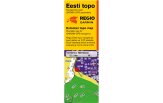

Regio Estonia TOPO v2 Memory Card
The full Estonian TOPO map on microSD with terrain, trails and address search for hiking and hunting.
Klubijäsenen edut
Lue lisää- Klubihinnat kaikille tuotteille
- Ilmainen pakettiautomaattitoimitus alkaen 150 €
- Voimassa 3 vuotta, jokainen ostos pidentää
- Kuukausittaiset jäsentarjoukset
Liity ilmaiseksi, kun ostoksesi on vähintään 150 €, tai klubikortilla (9,99 €).

Varastossa
Tondi
*Kuriirilla tai pakettiautomaatista jo 17.11

 4.8
866 arvostelua
GPS Eesti Googlessa


A new searchable, navigable TOPO map of all of Estonia on a microSD memory card.
NB! Since 16.11.2023 most Regio Estonia Topo maps come on 32 GB memory cards. Some older Garmin devices do not support memory cards of this size. Before buying, make sure your device supports 32 GB cards: What size memory card does my device support
Regio Eesti TOPO v2.23 NT
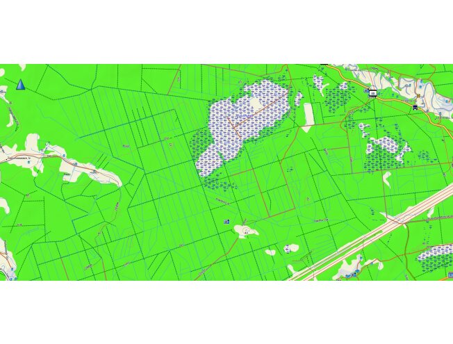
Address search works across Estonia in all settlements with named streets and building numbers.
Searchable points:
* settlements
* garden cooperatives and small settlements
* farmsteads (searchable by farm name under points of interest)
points of interest (POI info): petrol stations, sights, accommodation, food, shopping, emergency services, bus stops, lakes and much more.
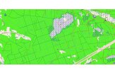
Map layers:
* forests and parks
* contour lines and forest rides
* roads and footpaths
* buildings (with numbers) and built-up areas
* water bodies and ditches
* bogs and nature reserves
* high-voltage power lines and railways
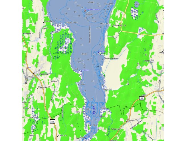
* 3D relief
Topo is not an update to the Regio Estonia road map but a separate product.
V 2.06 updates:
- Roads, addresses, buildings and points of interest have been updated.
- Maritime Administration data as of September 2018.
NB!
- The Maritime Administration data added to water bodies is informative and illustrative and does not meet marine navigation requirements. It is updated once a year and shown in reduced detail on the GPS screen. Therefore neither the Maritime Administration nor Regio OÜ accepts responsibility for its use. For marine navigation we recommend using official nautical charts.
NB! On older GPS devices (60CSx), there may be problems with accented letters when using the map. In that case use the letter without accents: Ä=A; Õ=O; etc.
V 2.05 updates:
- Roads and addresses have been updated.
- A separate update was made to the water network and terrain information, using new Land Board data for comparison.
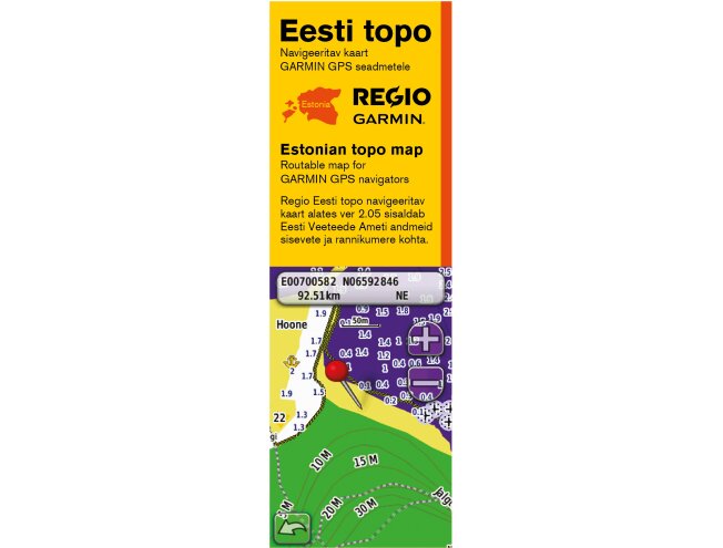
- In cooperation with the Maritime Administration, coastal sea information and the navigable part of inland waters were added to the map.
- Maritime Administration data: September 2018.
Changes in version 2.0:
- Compared with previous versions, most map layers have been updated, with especially many changes to roads, buildings and points of interest.
- An important new feature of the new maps is, in addition to the existing address ranges, address search by address points. This lets owners of newer devices (from the 13xx series) search not only by house number but also among more complex addresses (e.g. Põllu 48a, Kirde 34/38 etc.).
- Speed limit information has been partly added, except for the common limits of 50 km/h in built-up areas and 90 km/h outside them. The speed limit information added is not yet complete.
Questions and error reports are welcome at: kaardid@regio.ee
NB! Unfortunately, owners of earlier versions (1.12 and older) cannot update their maps to version 2.0
The Estonian topo map now includes Maritime Administration information on the Emajõgi river (from Lake Peipus to Lake Võrtsjärv; southern part of Võrtsjärv), Lake Peipus and the Narva river. The data comes from the Maritime Administration's 1:50,000 charts.
The topo map is best suited to handheld GPS units or Edge bike computers with map support.
It can also be used on Zümo motorcycle navigators, but for those we recommend the Regio Estonia Roads or Baltic Roads version instead.
Nüvi/Drive/Dezl series models are not designed to display topo information.
Due to relief information and other extras, the map may display slowly and cause the device to freeze.
Waterway information displays properly mainly on Garmin handhelds and dedicated navigators (e.g. GPSMAP 620)
ATTENTION!
The Regio Estonia topo navigable map has been compiled partly using data from the Maritime Administration's navigational charts.
WARNING!
The Maritime Administration has not checked whether the data from official navigational charts used in the product has been altered or partly deleted during its inclusion. The Maritime Administration is not responsible for incomplete data in the product and recommends using official navigational charts for navigation.
Neither GPS EESTI OÜ, the Maritime Administration nor Regio OÜ accepts responsibility for the use of the map.
Address search works across Estonia in all settlements with named streets and building numbers.
Searchable points:
* settlements
* garden cooperatives and small settlements
* farmsteads (searchable by farm name under points of interest)
points of interest (POI info): petrol stations, sights, accommodation, food, shopping, emergency services, bus stops, lakes and much more.
Map layers:
* forests and parks
* contour lines and forest rides
* roads and footpaths
* buildings (with numbers) and built-up areas
* water bodies and ditches
* bogs and nature reserves
* high-voltage power lines and railways
* 3D relief
Topo is not an update to the Regio Estonia road map but a separate product.
Tips for using the map on Garmin devices
Behaviour may vary between different Garmin devices!
Please note: The map must be activated on the device. Maps preloaded on memory cards cannot be copied or viewed on a computer. No other maps may be added to the memory card. If the map is deleted, it cannot be restored. Damaged maps will not be bought back or compensated.