



Skagerrak & Kattegat Navionics Vision+ NVEU645L
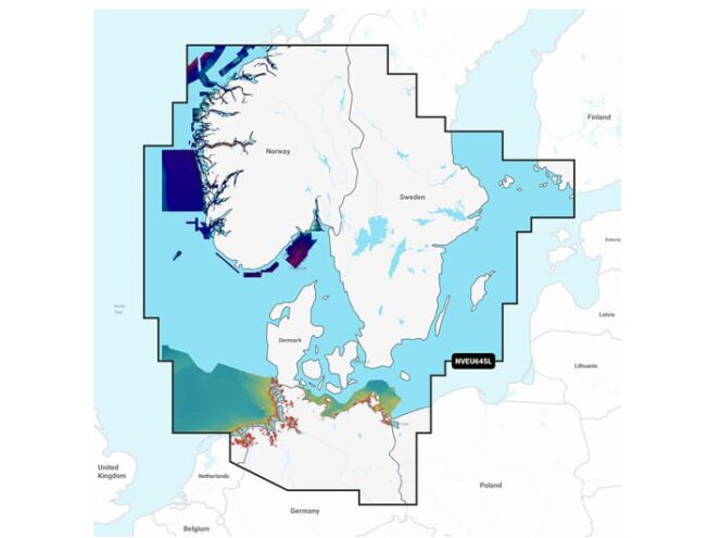
Skagerrak, Kattegat and approaches, with the Scandinavian coast from Kristiansund to Gävle.
Tällä ostoksella pääset klubijäseneksi ilmaiseksi
Lue lisää- Klubihinnat kaikille tuotteille
- Ilmainen pakettiautomaattitoimitus alkaen 150 €
- Voimassa 3 vuotta, jokainen ostos pidentää
- Kuukausittaiset jäsentarjoukset


 4.8
866 arvostelua
GPS Eesti Googlessa


Check whether your device supports the new Navionics+ charts: Marine chart compatibility
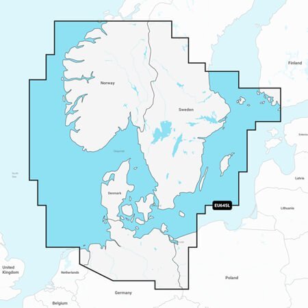
Detailed coverage of the Skagerrak and Kattegat and the approaches to them. Coverage includes the Scandinavian coast from Kristiansund, Norway to Gavle, Sweden; the Aland Islands; Turku, Finland; Gotland and Bornholm Islands; the Szczecin Lagoon; the Kiel Canal and all of Denmark. Ports include Oslo, Norway; Malmo and Stockholm, Sweden; Copenhagen and Aarhus, Denmark and Hamburg, Germany. Lakes include but are not limited to Lakes Vänern, Vättern, Mjörn, Sommen and Uddjuar in Sweden and Lakes Mjøsa, Bandak, Flåvatn, Norsjø and the Telemark Canal in Norway.
ALL-IN-ONE MAP SOLUTION FOR GARMIN CHARTPLOTTERS
Use detail-rich charts of coastal waters, lakes, rivers and more. Integrated Garmin and Navionics content provides charts for boaters all over the world.
DAILY CHART UPDATES
Charts are constantly being enhanced with new and amended content, with up to 5,000 updates made every day. The included one-year subscription gives access to daily chart updates via the ActiveCaptain smart device app.
AUTO GUIDANCE+ TECHNOLOGY
Garmin and Navionics auto routing features and built-in Auto Guidance+ technology2 provide a suggested dock-to-dock route through channels, inlets, harbour entrances and more.
DEPTH RANGE SHADING
High-resolution depth range shading lets you select up to 10 colour-shaded options and view your designated target depths at a glance.
UP TO 0.5 METRE CONTOURS
Up to 0.5 m contours give a better representation of the bottom for improved fishing and navigation, with a detailed view of marshes, canals, ports and more.
SHALLOW WATER SHADING
To give a clear picture of shallow waters to avoid, this feature allows for shading at a user-defined depth.
ACTIVECAPTAIN COMMUNITY
Community-sourced content includes useful points of interest such as marinas, anchorages, hazards, businesses and more. Get recommendations from boaters who know the local conditions.
RELIEF SHADING
Highly detailed shading3 with colours and shadows gives an easy-to-interpret, clearer view of bottom structure than contour lines alone.
HIGH-RESOLUTION SATELLITE IMAGERY
High-resolution satellite imagery provides superior situational awareness.
AERIAL PHOTOS
Crystal-clear aerial and surface photos of ports, marinas, bridges, docks, boat ramps, dams and navigational landmarks provide a better sense of your surroundings above the waterline.
3D FISHEYE VIEW
This underwater perspective shows 3D representation of bottom and contours as seen from below the waterline. Interface with sonar data for a customised view.
3D MARINEREYE VIEW
This view provides a 3D representation of the surrounding area both above and below the waterline.
