



Northern Europe G3 HD Vision VEU721L
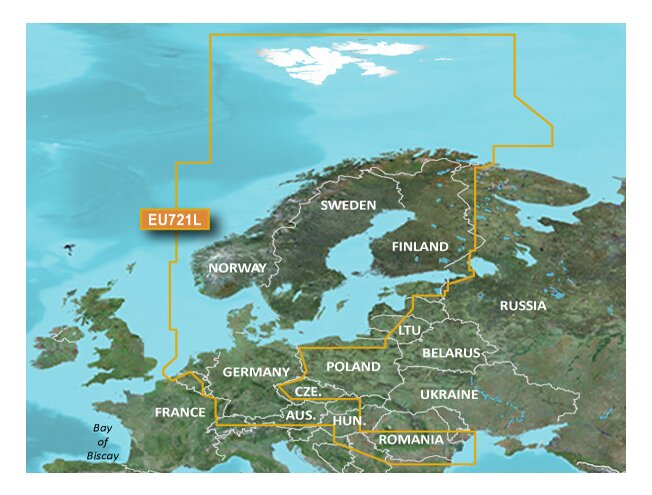
Northern European coasts and open sea from Norway and Denmark to Estonia and Poland, plus Lake Peipus.
Tällä ostoksella pääset klubijäseneksi ilmaiseksi
Lue lisää- Klubihinnat kaikille tuotteille
- Ilmainen pakettiautomaattitoimitus alkaen 150 €
- Voimassa 3 vuotta, jokainen ostos pidentää
- Kuukausittaiset jäsentarjoukset

Varastossa
Tondi
*Kuriirilla tai pakettiautomaatista jo 17.11

 4.8
866 arvostelua
GPS Eesti Googlessa


Detailed offshore and coastal charts of the Nordic countries, including Norway, Sweden, Finland and Denmark. Coverage: Svalbard; the North Sea; the Baltic Sea; the Skagerrak and Kattegat straits; the Gulfs of Bothnia, Finland and Riga; the coasts of Russia, Estonia (also including Lake Peipus and the Emajõgi River), Latvia, Lithuania, Poland, Germany, the Netherlands and Belgium. Also covers the inland waterways of Finland.
Supplied on a microSD/SD memory card. Suitable for devices that support G2 HD Vision charts. In addition to other data, it also includes: tides, currents, marine POIs, IALA symbols, 3D chart view, fishing charts and a “Safety Depth” setting on compatible devices. Includes automatic route generation (Auto Guidance) on compatible devices.
Please note: charts preloaded on memory cards cannot be copied or viewed on a computer. Do not add other maps to the memory card. If the chart is erased, it cannot be restored. A damaged chart will not be bought back or compensated. To update the charts on your memory card, connect the memory card to a computer and open the Garmin Express program. (Updates are subject to a fee.)
