



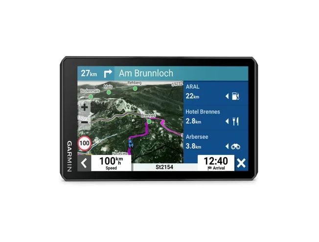
Garmin Zümo XT2
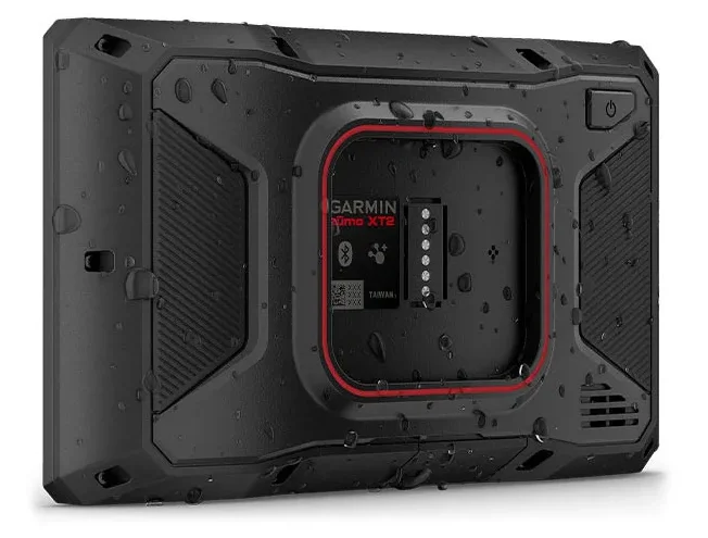
Innovative adventure motorcycle sat nav with a large bright display, smart route planning and helmet speaker compatibility.

This product is archived (discontinued) and is shown for information only.

 4.8
861 reviews
GPS Eesti on Google


THE RIDE OF YOUR LIFE
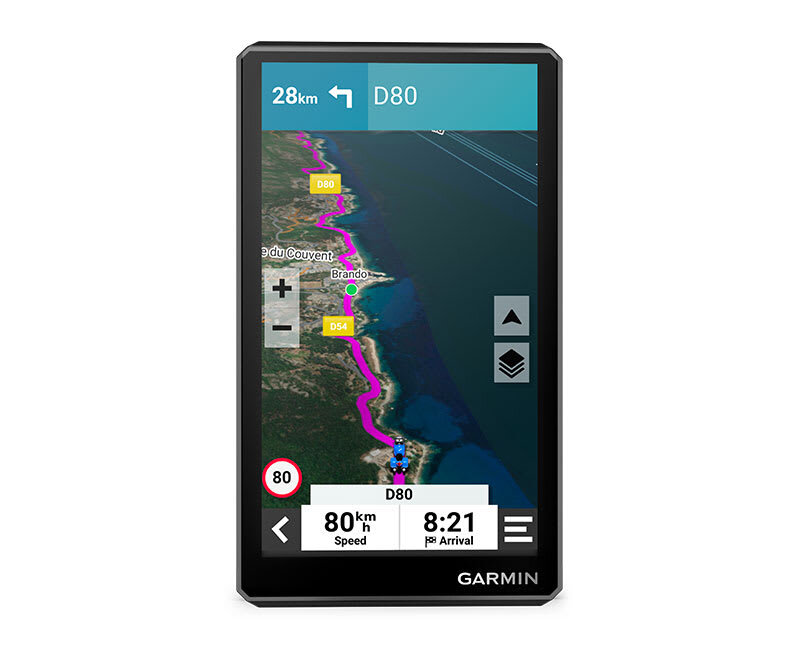
You need moto therapy. The zūmo® XT2 motorcycle sat nav is your prescription for hitting the road wherever it leads. The bright 6″ display is glove-friendly and packed with features to help you find the perfect motorcycle route.

Whatever the weather or light conditions – the bright 6″ display is always easy to read.

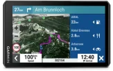
Preloaded with the MICHELIN Green Guide and Scenic Roads

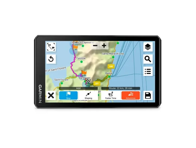
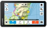
Create custom routes with the visual route planner.

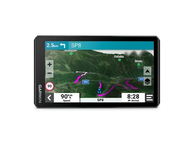
Find all the twists and turns with the Garmin Adventurous Routing™ setting.

See popular motorcycle routes and discover new places to ride.

TOP FEATURES
 |  | 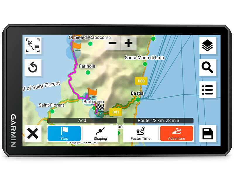 |
| BRIGHT DISPLAY | BUILT TOUGH | VISUAL ROUTE PLANNER |
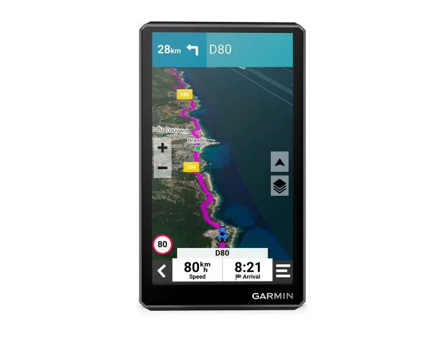
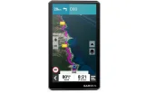
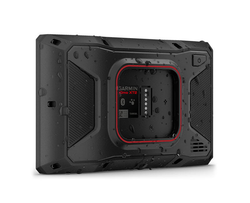
| This 6″ display is 15% larger than previous models and even brighter with high resolution in landscape or portrait mode. | Rain? Vibration? Dust? No problem. This device is built to withstand all weather (IPX7) and rough terrain. | Plan your route on the device or use the app with a compatible smartphone. |
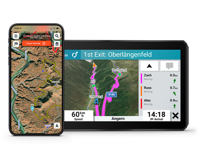 | 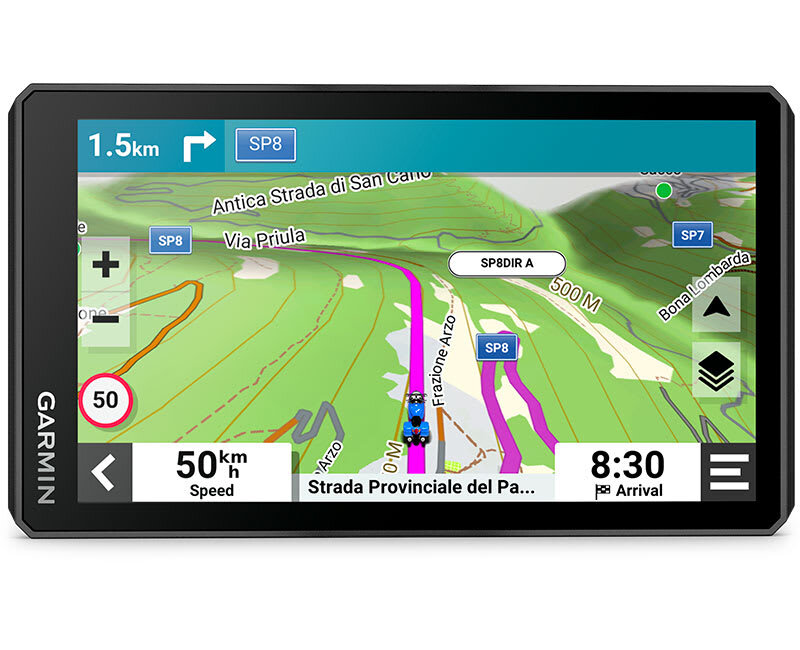 | 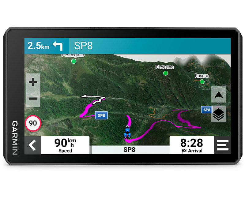 |
| GROUP TRACKING | EASY MAP SWITCHING | SATELLITE IMAGERY |
| Use the Tread® app on your smartphone and/or zūmo XT2 to track friends with the Group Ride Mobile feature1. Or use the group ride tracker2 accessory (sold separately) to track other riders with a zūmo® XT2 without needing mobile coverage. | Easily switch between road maps, topographic maps and satellite imagery, so you can always choose the best map for your ride. | Navigate with satellite imagery from around the world. Download these maps directly to your device using Wi-Fi® technology3. No annual subscription required. |
BUILT FOR RIDERS. DESIGNED FOR MOTORCYCLES.
NAVIGATION
| |  |
| GARMIN ADVENTUROUS ROUTING | MICHELIN SCENIC ROADS | POPULAR ROUTES |
| Straight roads are boring. Find the most exciting routes with hills, curves and points of interest, and choose from 4 difficulty levels. | Discover unforgettable journeys with MICHELIN Scenic Roads maps. Easily add them to your trip with the visual route planner, or select a highlighted green route directly on the map and simply start riding. | See other motorcyclists' popular routes to find new and exciting journeys to explore. |
 |  |  |
| RIDE SUMMARIES | TRACK RECORDING | SHARE YOUR FAVOURITE ROUTES |
| Use the Tread® app to review the details of your ride, including speed, acceleration, deceleration, elevation and more. | Record your ride data such as speed, distance, acceleration and much more, and share the details with friends in the Tread® app. | Easily send GPX files from your phone or third-party sources to your zūmo® XT2 sat nav. Share GPX files with fellow riders using the Tread® app. |
 | ||
| MANAGE YOUR DATA | ||
| Easily manage tracks and routes on your sat nav and compatible smartphone with the Tread® app4. |
TRAVEL FEATURES
|  | |
| MICHELIN GREEN GUIDE | TRENDING PLACES SUGGESTIONS | LOCAL PLACES |
| The preloaded MICHELIN Green Guide includes photos, detailed descriptions and ratings so you know what's worth a stop. | Discover the best places along your route with trending places suggestions. | Search for local places to visit and exciting things to try near your current location using local points of interest suggestions. |
 |  | |
| RIDER ALERTS | MUSIC | |
| Get alerts for hazards on your route, such as upcoming sharp curves, speed limit changes and more. | Stream music from your smartphone through the zūmo® XT2 sat nav or play MP3 files stored on the sat nav – all to your connected helmet or headset. |
CONNECTED FEATURES
 |  |  |
| WIRELESS UPDATES | MAPS WITH EXTENSIVE COVERAGE | LIVE TRAFFIC AND WEATHER |
| Built-in Wi-Fi3 connectivity makes it easy to keep maps and software up to date without a computer. When updates are available, a notification appears on the screen. | Preloaded topographic maps of Europe and the Middle East with 3D terrain and street maps. Maps of Africa, including Tracks4Africa, North and South America, Australia and New Zealand are available as free downloads at garmin.com/express. | Through the Tread® app, access live traffic and weather information, share routes with other riders and receive phone notifications4. |
 |  |  |
| INCIDENT NOTIFICATION | BLUETOOTH® CONNECTIVITY | INREACH® COMPATIBILITY |
| In the event of an incident, a text message with your location is automatically sent to your preselected contact4. | Hear detailed directions or make hands-free calls from your compatible smartphone through your connected helmet or headset. | Pair the zūmo® XT2 with a compatible inReach satellite communicator5 for two-way messaging, location sharing and SOS functions in an emergency. |
 | ||
| ACCESSORY CONTROL | ||
| Pair the zūmo® XT2 motorcycle sat nav with a compatible Garmin PowerSwitch™ digital switch box (sold separately) to control your motorcycle's 12-volt electronics from the display. |
1 Tracking via Group Ride Mobile requires the Tread app running on a compatible smartphone with Bluetooth® technology and an active mobile connection for you and each of your friends.
2 Group tracking with the group ride tracker accessory is only available to riders using the zūmo® XT2 sat nav and the app. Group tracking requires connection to the vehicle's power system.
3 Active Wi-Fi connection required.
4 Requires zūmo to be paired with your smartphone with Bluetooth® and GPS technology and the Tread® app.
5 Satellite subscription required. Some jurisdictions regulate or prohibit the use of satellite communication devices. It is your responsibility to know and follow all applicable laws in the jurisdictions where you intend to use the device.
© HERE. All rights reserved. Satellite imagery © 2023 Maxar Technologies (date of satellite imagery may vary). Wi-Fi is a registered trademark of the Wi-Fi Alliance. The Bluetooth® word mark and logos are registered trademarks owned by Bluetooth SIG, Inc. and are used by Garmin under licence. Copyright © Michelin Editions ©2023
General | |
| PHYSICAL DIMENSIONS | 15.6 x 8.9 x 2.5 cm (6.15” W x 3.5” H x 1” D) |
|---|---|
| DISPLAY SIZE | 13.3 x 7.5 cm (5.3”W x 3.6”H); 15.3 cm diag (6”) |
| DISPLAY RESOLUTION | 1280 x 720 pixels |
| DISPLAY TYPE | Multi-touch, high-brightness, HD colour TFT glass display with white backlight |
| DUAL-ORIENTATION DISPLAY |  |
| WEIGHT | 340 g (12 oz) |
| WATER RATING | IPX7 |
| BATTERY TYPE | Rechargeable lithium-ion battery |
| BATTERY LIFE | Up to 6 hours (up to 3.5 hours at 100% backlight) |
| DROP RATING | MIL-STD-810 |
| HANDLEBAR MOUNT (UP TO 1 INCH) | |
Maps & memory | |
| PRELOADED STREET MAPS | |
|---|---|
| DATA CARDS | microSD™ card (not included) |
| 3D TERRAIN | |
| INTERNAL MEMORY | 32 GB |
| ABILITY TO ADD MAPS | |
| MEMORY AND POWER | Yes (max 256 GB microSD™ card) |
| INCLUDES MAP UPDATES | |
| DOWNLOADABLE SATELLITE IMAGERY | Yes (BirdsEye) |
| BIRDSEYE DIRECT SATELLITE IMAGERY | |
Sensors | |
| GPS | |
|---|---|
| GALILEO | |
| 10 HZ MULTI-GNSS POSITIONING | |
Outdoor recreation features | |
| POINT-TO-POINT NAVIGATION | |
|---|---|
| PRELOADED TOPOGRAPHIC MAPS | |
| TRACK NAVIGATION | |
Navigation features | |
| VISUAL ROUTE PLANNER | |
|---|---|
| GARMIN REAL DIRECTIONS™ LANDMARK GUIDANCE | |
| TRIPADVISOR® TRAVELLER RATINGS | |
| ROUTE PLANNING VIA PREFERRED CITIES/STREETS | |
| TRAFFIC UPDATES | Yes (with Tread app) |
| LANE ASSIST WITH JUNCTION VIEW (DISPLAYS JUNCTION SIGNS) | |
| BLUETOOTH® CALLING | Yes (works with Bluetooth-compatible helmet, headset or smartphone. BLE capable.) |
| SPEED LIMIT INDICATOR (DISPLAYS SPEED LIMITS FOR MAJOR ROADS IN EUROPE) | |
| DRIVER ALERTS FOR SHARP CURVES, SCHOOL ZONES, RED LIGHTS, SPEED CAMERAS AND MORE | |
Detailed features | |
| SMART NOTIFICATIONS VIA APP | |
|---|---|
| WI-FI® MAP AND SOFTWARE UPDATES | |
| ACCESS TO LIVE SERVICES VIA APP | |
Motorcycle features | |
| MUSIC AND MEDIA CONTROL FROM SMARTPHONE OR MP3 PLAYER | |
|---|---|
| SUNLIGHT-READABLE AND WATERPROOF | |
| GARMIN ADVENTUROUS ROUTING™ | |
| RIDER ALERTS FOR SHARP CURVES, SPEED CAMERAS, ETC. | |
| PLANNED AND DYNAMIC FUEL STOPS | |
| POPULAR ROUTES (MOTORCYCLE) | |
| ELEVATION PROFILE | |
| ROUND-TRIP ROUTING | |
| SERVICE HISTORY LOG | |
| TRACKING SUPPORT | |
| CUSTOM MAP SUPPORT | |
| TOPO MAP SUPPORT | |
| ANT+® WIRELESS TECHNOLOGY | |
Off-road features | |
| PAIRS WITH COMPATIBLE INREACH® DEVICE | |
|---|---|
| PAIRS WITH GARMIN POWERSWITCH | |
| GROUP RIDE TRACKER COMPATIBLE | Yes (6", 8" and 10" versions only) |
| GROUP RIDE MOBILE | |
| TRACK RECORDER (TRACK LOG) | |
| COMPATIBLE WITH THE GARMIN TREAD APP FOR ROUTE PLANNING AND DATA MANAGEMENT (WAYPOINTS, TRACKS AND ROUTES) | |
| GLOVE-FRIENDLY TOUCHSCREEN | |
- zūmo XT2
- Motorcycle mount and hardware
- Motorcycle power cable
- Charging/data cable
Frequently asked questions
How often are map updates released?
Garmin City Navigator kaardiuuendused ilmuvad tavaliselt kuni kolm korda aastas.
Eluaegse Euroopa kaardi uuenduse ostjad saavad laadida uusi kaarte otse internetist kuni 3 korda aastas.
Kaarte saab uuendada Garmin Express programmiga.
Traffic information coverage in Europe
Garmin FM traffic information coverage in Europe
(LMT/MT-D):
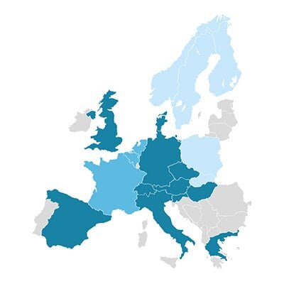
 Available
 Available until December 2025
 Available until March 2025
LMT/MT-D devices can also use traffic information from the Smartphone Link/Garmin Drive app via a smartphone*.
Garmin Smartphone Link/Garmin Drive app traffic information coverage in Europe
(LMT-S/ MT-S)*:
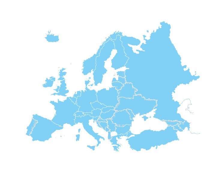
 Available
*Requires a smartphone with an internet connection. Average data usage ~2MB per hour
Mass storage mode on newer Garmin devices
Newer Garmin devices no longer connect to a computer in mass storage mode, but as media devices. This means older Garmin applications cannot be used, and sometimes there may be problems updating the device. To put the device into mass storage mode, follow these instructions: Turn...
What is GPS and how accurate is it?
WHAT IS GPS? The Global Positioning System (GPS) is a satellite navigation system owned by the US government, currently made up of at least 24 operational satellites. GPS works in any weather conditions, anywhere in the world, 24 hours a day, with no subscription or setup fees. T...
