



Baltic Sea, East Coast Navionics+ NSEU081R
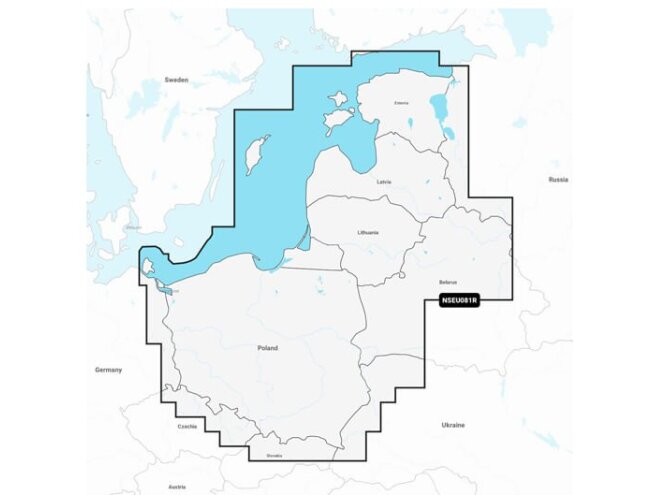
Eastern Baltic coast from the German border to Narva-Jõesuu, plus Baltic and Polish lakes and rivers.
This purchase makes you a club member for free
Read more- Club prices on all products
- 1 free parcel locker delivery a year
- Valid for 3 years, every purchase extends it
- Monthly member offers

 4.8
866 reviews
GPS Eesti on Google


Check whether your device supports the new Navionics+ charts: Marine chart compatibility
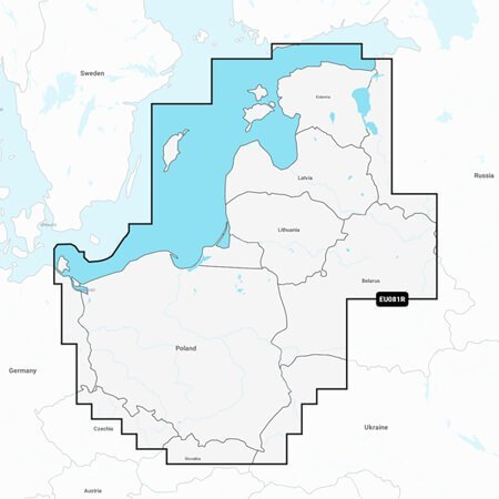
Coastal coverage of the Baltic Sea coasts of Poland, Russia, Lithuania, Latvia and Estonia from the German border to Narva-Jõesuu in Estonia, as well as lakes and rivers of Poland, Belarus and the Baltic States. Coverage includes the Gulf of Riga, the Szczecin, Vistula and Curonian lagoons, the islands of Gotland, Saaremaa and Hiiumaa, the Oder, Vistula, Bug, Neman, Emajõgi and Daugava rivers, lakes Peipus, Pskov and Võrtsjärv, the Masurian Lake District including Lake Jeziorak, Lake Łańskie and Lake Śniardwy, and lakes Snudy/Strusto, Miastra, Batorino, Lukomskoye and Selyava in Belarus. Ports include Tallinn (Estonia), Riga (Latvia), Gdynia and Gdańsk (Poland) and Kaliningrad (Russia).
ALL-IN-ONE MAP SOLUTION FOR GARMIN CHARTPLOTTERS
Enjoy detailed charts of coastal areas, lakes, rivers and more. Integrated content from Garmin and Navionics delivers charts for boaters around the world.
DAILY CHART UPDATES
Charts are continuously improved with new and updated content, with up to 5,000 updates made daily. The included one-year subscription gives you access to daily chart updates via the ActiveCaptain smart device app.
AUTO GUIDANCE+ TECHNOLOGY
Garmin and Navionics auto-routing features and built-in Auto Guidance+ technology2 provide a suggested dock-to-dock route through channels, inlets, marina entrances and more.
DEPTH RANGE SHADING
High-resolution depth range shading lets you select up to 10 colour-shaded options and view your designated target depths at a glance.
UP TO 0.5 METRE CONTOURS
For better fishing and navigation and a detailed view of marshes, canals, ports and more, contours of up to 0.5 m give a better representation of the bottom.
SHALLOW WATER SHADING
To give a clear picture of shallow waters to avoid, this feature allows for shading at a user-defined depth.
ACTIVECAPTAIN COMMUNITY
Community-sourced content includes helpful points of interest such as marinas, anchorages, hazards, businesses and more. Get recommendations from boaters with local knowledge.
